Adventures in Mexico
We left Mel's folks house after the holidays and headed towards Mexico. It was obvious it was time to leave Dallas as a snow storm was heading that way. We try to make it a point to leave a place whenever it snows (at least while camping). We were outfitted with our 4X4 Van named the Mystery Machine, and all the camping stuff we could use. After spending the last 7 months up in Alaska our setup was complete. We crossed over the border at El Paso/Ciudad Juarez and our adventure began.
Borders are always fascinating. You are in one country and five feet later you are in a new country. The US/Mexico border is the only one in the world with a first world and third world country sharing the border. The terrain in the SW US was very similar to the NW of Mexico. The immediate difference was the garbage along the highway and the poor shape of the buildings. The North in general was strange in that people were either hard-working and poor or drug running and wealthy. At least that was the word.
As usual, we had a plan to avoid all border hassles and cross to the west of the main crossing. There was a new border with all the modern conveniences established (or so we thought). As with planning border crossings, we soon ended up in a wild goose chase getting the necessary permits to import a vehicle into Mexico. We spent the better part of the day driving through Ciudad Juarez until we finally learned the office which had this was well south of town. It seems that it is relatively simple to cross the border and stay in the 'border zone'. No permits are necessary, and if you stay within the zone you can cross at will. To enter Mexico below about 100 miles you need to have a vehicle permit. This entails getting the necessary paperwork, a nice decal for the window, and paying fees which include a $500 deposit you must give to bring a vehicle into the country. If you leave with your vehicle, you get it back. If you don't you forfeit the $500.
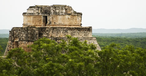
Anyway from the border we drove to Casa Grande to see the Paquime Site. Paquime is the location of a city in the desert inhabited about 1000 years ago. The civilization fell, but this site and a few in the states remain. The site is much better than the one in Arizona. They have an excellent museum artifacts from the city. Most of the bus tours to Copper Canyon stop here. One was there when we visited.
From there we headed South into the mountains to a place called Valle de La Cuevas. The road up was atrocious, but the Mystery Machine is made for this kind of travel. We ended up camping in a great spot in the valley and had the whole place to ourselves. The Valle de la Cuevas is a long canyon sculpted by streams and it's full of cave dwellings. We spent 3 days exploring the caves on our own. One morning a friendly Rancher showed up on his horse and guided us to several new sites. The caves are fantastic and full of pueblas. We will have some pictures on the site soon that show the famous Cueva de la Olla (cave of the potter). This cave has pueblas and a large corn crib inside.
The area is designated as a reserve, though the ranchers are free to till the valley floor as long as they leave the caves alone. We saw stone tools, pottery shards and many pueblo filled caves. You could spend weeks up there exploring as the area is filled with valleys, all inhabited by the Paquime culture. We visited another area about 50 miles away called Quarenta Casas that was similar but under much tighter control. In Valle de la Cuevas, you were pretty much on your own for exploring.
Moving on to Copper Canyon
We decided to head out, but instead of back-tracking, we wanted to drive through the mountains. The area here is beautiful with lots of small towns and Ranches up in the mountains. The locals get by on farming, raising livestock, and timber cutting. Most of the large trees were all cut here but the scenery was still good with the second growth coming on. We spent 6 hours driving from V. de la Cuevas near the town of Ignacio Zaragoza to Madera (about 120 km). The roads were rough at times, and of course unmarked.
Navigating off the Map
There are lots of great roads in Mexico, but if you want to get out into the country, you find yourself off a map pretty quickly. We were armed with a Mexico Tourist Road Atlas from Guia Roji. This shows most of the paved roads and some of the gravel roads, but you can be sure there is a road most anyplace you might want to get. We had 1 great Topo map(1 to 250,000 scale with 1 to 50,000 also available but only in Mexico) too, but they are hard to find.
Navigating off the map entails stopping at each cross road and waiting for the next Mexican that happens by. You ask which way to the town your are heading for. You can easily wait a couple of hours at a cross road depending on how busy the road. Fortunately, if there is a road in Mexico, you can be sure there is a reason for it. We have found most roads have some traffic. If you are particularly bold or have developed your senses, you can usually determine which road has the most traffic, which is usually where you want to go. Once you make it into town, you can ask which road goes to the next town and so on. GPS comes in handy if you have topo maps, but you have to be sure you are using the same datum or reference grids as the map in hand.
Getting Money in Mexico
Mexico is an interesting place that is being dragged kicking and screaming (thanks or no thanks to NAFTA) into the global economy. There are two ways to get money in Mexico. Either have USD or USD denominated travelers checks, or if you are really lucky, there will be an ATM machine in town. Our first attempt involved travelers checks.
In Mexico, the banks are open for foreign exchange for only certain hours in the morning. After 12 or 1pm, you will not necessarily be able to exchange money, even though the bank is open a few more hours. The next option is the Casas de Cambio, or private money-changers. Of course if you just miss the bank hours, the Casas de Cambio will be on Siesta from 1-3pm. So you have to wait around till one opens. There are places you can use your credit card, but every gringo we met in Mexico had their story of credit card fraud (at banks, restaurants, basically everywhere) and strongly recommended we not use ours. We did use our credit cards, but only in a couple of instances where I felt comfortable (in premium hotels for example).
The Roads:
If you stick to the tourist maps, they only show the roads that you can be reasonably sure are well maintained. These are usually paved and if not, graded on a regular basis. Just because the road is paved doesn't mean that the driving is easy. There is often no shoulder on the road and if you leave the pavement it would be a bad thing. Big trucks like to take wide turns so this can be a problem on blind turns. We used our horns when approaching these just to let the oncoming traffic know. Of course the Mexicans don't use their horn, so they might know you are coming, but you will not know about them. Fortunately, they are not prone to having a death wish and will generally give room if they know you are coming. We did have an occurrence in Baja where we got to see the entire whites of a drivers eyes as were negotiating a turn.
Of course the rule of not driving at night is important. The locals usually had their lights on, but they could easily be drunk. Especially on Friday or Saturday night. One of the pleasures(?) of Mexico is that it is legal to drive and drink. You cannot be drunk however. Cows like to graze on the road and provide a real hazard especially when the cow is black and in the middle of the road. The lack of a shoulder makes this even more important. We very rarely (maybe twice in 3 months) drove at night.
Back to our Story.. Creel and Copper Canyon (Baranca de Cobre) Our goal was to travel through Copper Canyon on mythical roads that were not on the available maps. There were legends and folk tales of gringos making their way through and at least 4 separate paths are secure in the travelers mythology. We made it on the usual roads from Madera to Creel, the gateway to the canyons. Creel is the main supply point for the canyons and a nice little town. There are loads of tourist accommodations from the usual $100+/night to backpacker places starting at $6 including dinner and breakfast. We found our way to one of the backpacker variety, Casa de Margarita's.
Margarita is a real person who has been running a Hostel in town for many years. She has been so successful that she now owns or operates a number of the $100+/ night places in town and the $200+/night places in the canyons. We ended up hanging out in our room living with the luxury of heat and hot water. Of course we got snowed on here too and had to leave. Before driving through we decided to take the train journey through the canyon as it is supposedly the best in North America (the Canadians might dispute this).
The train ride is an established tourist route and bus tours run from Tucson to Los Mochis where the train is boarded and the group is met again in the town of Divisadero where the bus takes them on to Casas Grandes before returning home. The train runs through a part of the canyon where there are no roads. The scenery is absolutely breathtaking as the canyon walls are very narrow for the western part of the ride. As you take the train west you miss the best part as it is dark, but coming east, you are in the canyon areas during daylight hours. Two trains run each day, the first class and the second class. There is not much difference between the two. Mainly first class is double in price and has nice white table cloths and better food. The second class train has great seats and people selling burritos, chili Rellenos, sodas, and candy. Also, on the eastbound, the second class train leaves later giving you a chance to sleep in.
The train ride lived up to it's billing and the eastbound trip provides the best views due to the time of day. The canyon is actually four large canyons all connected. It is written that Copper Canyon is four times the size of the Grand Canyon. Near the bottom it is warm and tropical with fruit trees. As we climbed the vegetation changed from lush to pine and eventually to scrub. Once we made it back to Creel we stayed the night at Margaritas and headed out the next day. Our first stop was Divisadero. The trains stop here each run as the view is spectacular. There is a nice hotel at this spot with a great bar that hangs on the edge of the canyon. The sunset views are worth the whole trip. We made friends with one of the bus drivers for a tour group. We tagged along with the group and had dinner in the restaurant. We camped across the street.
From there we drove to Bahuichivo over some rough roads snapping one of our shock absorbers on the way. The moment of maximum anxiety occurred when we approached a bridge made from old rails laid lengthwise from the railroad. I was unsure of whether we would just slip off the side, but a rider we picked up said it was OK and it was. Bridges are a good use for old rails apparently. We picked up our rider as her truck had broken the mounts for the rear leaf spring! She was going to the Paradiso Del Oso, a horse ranch that we were also going to. We spent the night there and marveled at the fact that the ranch had rustic rooms with no electricity (or guests at the time) that rented for $150 USD/night. We stayed in the dorm for $10. The next day we did a 4 hour horse ride on the 'Best Saddle Stock in the Canyon'.
From here we drove down to Urique in the bottom of the canyon. Urique is reached via a class 5 white knuckle ride 6000 feet down into the canyon. The road is carved from the rock and with one lane winds down the side of the canyon providing spectacularly scary views and the occasional Guadalupe shrine. If you take the bus it is better because, since it is done at night, you are unaware of your impending demise should the driver make a mistake.
The views from the road going down were easily the best we had seen in the canyon. The sides of the canyon drop dramatically down into the bottom with some visible terrace farms on the tops and in any of the flat spots. The canyon is wide so you have a lot of view. There had been good rain recently providing many different shades of green. It looked like you were descending into a lost world.
It took us about 4 hrs to drive from Bahuichivo to Urique, mostly spent on the decent. The road was fair, (This is Mel...Rob is crazy-the road was HELL!) but I had to put the Mystery Machine in 4 WD Low to save the brakes. We made it to Tom and Keith's place in the town just after sunset. Here we camped for a few days and met the resident caretaker (at least for a couple of months). The property is owned by two couples. The men are gringos and their wives are Mexican. They live in the States over the winter and stay in Urique during the summer. They are always looking for good caretakers if the 100 km from Bahuichivo to Urique, mostly spent on the decent. The road was fair, but I had to put the Mystery Machine in 4 WD Low to save the brakes. We made it to Tom and Keith's place in the town just after sunset. Here we camped for a few days and met the resident caretaker. The property is owned by two couples. The men are gringos and their wives are Mexican. They live in the States over the winter and stay in Urique during the summer. They are always looking for good caretakers is anyone is interested. Care taking gives you free room in the main house, but you are on your own for maid and cooking service. It provides a good opportunity to work on your Spanish.
We found the place comfortable and enjoyed the company so we stayed about a week. They had a nice garden and lots of fruit trees and the elusive hot shower. Luxury. We soon met another of the area's resident gringos. This fellow is a guide who has been traveling in the canyon for the better part of 8 years. He took me (Rob) out panning for gold with his pet wolf. He also provided interesting company talking about the idiosyncrasies of canyon life. He and his partner work as guides in the canyon and contract out to the resorts in addition to finding additional work as it comes along.
Driving West over the Sierra Madre
It didn't snow on us, but we were anxious to get moving. We were hoping to find a nice beach to vege out on so it was time to go. We drove out of the canyon and spent the night in Cerocahui. The next day we were off on more uncharted roads. Fortunately we had a good 1 to 250,000 Topo map of the region which did show the road we were going on. This scale at least could point us in the general direction and showed all the small towns along the way. Fine directions could be had using the wait and ask method.
The road was excellent from Urique all the way to Chinepas with a stop at the famous three level railway switchback in Temoris. Temoris is a great town located in the area of the best scenery on the rail ride. The canyon here is steep and narrow. Not nearly as deep as Urique (the rail line doesn't go to Urique), but much narrower providing spectacular views. We met an English speaking Mexican guy who told us about lots of hiking opportunities in the region. The train stops here and would be well worth a few days stop for any adventurous hiker types.
We wanted to get a picture of the train on the switchback, but it was running late so we drove on to Chinepas. Chinepas was the staging point for supplies into the canyon for hundreds of years before the rail line was built. The road there was good, and the scenery excellent. We made it into town after sunset and soon noticed the large number of Federales (FBI equivalent), Police, and Army. There is a lot of smuggling in the Canyons and they are here to 'Police' the action. One of the reasons not to drive at night is the presence of vehicles that may be carrying contraband. You don't want to get between them and the authorities.
We tried to find a camping spot and soon attracted the attention of the roving bands of police. We ended up in a Hotel room as the town gave us the creeps. It was a pretty big town considering how remote it was. There is at least one road in from the West that is used for supplies, but we found it to be pretty rough.
Leaving Chinepas, your first endeavor is to cross the river. There is no bridge, so you have to aim for the tire tracks on the other side and pray you don't stall out during the crossing. I put the MM in 4 Low again to keep the backpressure up in the exhaust as we made our way through. The water was over the wheels in the middle of the river, but we made it. Whew! The fun had only begun. The previous night we were parked behind a road grader. We soon found out where it had gone as they had done the first pass of road grading. This entails taking all the rocks and assorted debris from the side of the road and moving it to the middle where it could then be spread across the road. We picked our way through the head sized rocks hoping we would not puncture our tires. This went on for about 4 miles. We caught up to the grader and passed him thinking our problems were over.
We now started to climb the mountain. Since Chinepas is no longer an important town, the road has not been upgraded. This was without a doubt the worst road we traveled on during the entire trip. The road was plowed into a stream bed as it switch backed its way up over 6000 ft crossing the continental divide. It took us 6 hours to make it the 100 km (60 miles or so) to Alamos on the other side. Once we made it to the top we had spectacular views that reminded me of the mountain scenery around Rio de Janeiro. There are these huge peaks in the Chinepas valley that are quite magnificent. On the way down we met up with a Tecate beer truck working its way over to Chinepas. People will do anything to get a beer.
The ride down the other side was almost as bad as the way up. The road is basically carved out of rock or stream beds a lot of the way. We are amazed to report that we did not suffer one flat tire on the entire way! I have become a true believer in BF Goodrich All-Terrain Tires!! We made it to Alamos for the afternoon and relaxed in a RV park. It didn't take long for a girl selling Tamales to find us. Mexico is a great place. If you wait around long enough, someone will come by with food for sale. Luscious tamales for about a quarter each (2.5 pesos).
Alamos
Our guidebook and the backpacker word was that Alamos was an American yuppie version of a Colonial Mexican town. Created during the Heyday of silver mining, it is a beautiful town with lots of old Spanish Casonas (mansions) restored by Americans and Canadians. It was founded in 1683, and served as a capital of the state in the 1800's and was one of Mexico's richest towns at one time. We enjoyed the atmosphere and the availability of an ATM machine, good food, great people, and lots of the touches that can be provided by foreigners in the third world setting (good coffee, great restaurants, internet access, etc.).
We soon discovered there was a shamanic healing camp going on with some native American Shamans, a massage therapist, and even a didgeridoo healer. We decided to join and soon found ourselves in the Alamos gringo circuit. The camp was great and we soon moved the operation out to the coast on a property located on an Estuary west of Alamos. Each day we were greeted by t he resident dolphins as they made their daily runs along the coast. We had a glorious week with our new friends out at the Estuary and decided to come back ourselves for a couple of weeks. We rode back to Alamos with everyone and visited some new friends in town before heading back out to the beach house. Here we spent the next two weeks with the place to ourselves. We had our boat, so we were able to drive around the bay and out to the ocean. We had a great time running the boat with dolphins riding our bow wave.
We had a great 2 weeks with fire in the fireplace and even a propane Fridge. We even had a couple of re-supply runs as our friend Chris brought out the beer and the carne (steaks!!). As usual, every few days a guy drove by selling tortillas and anything else you wanted. What a place. From there we drove back to Alamos to hang out for a couple of days before driving over to Topolabampo for the ferry to La Paz, Baja Mexico. We highly recommend Alamos as a destination in the winter. It is easily reached from Tucson and you can come with a Sonora Only tourist permit. There are lots of great B&B's in the area and one fabulous resort (great for dinner).
People have asked what we do when we have that much time on our hands. When we are traveling about we spent most of our time exploring new areas. We hike, bike, go to museums, talk with people (locals and other travelers) and read. We eat, sleep and do regular things too like laundry, writing letters etc. This was one of the first times we had stopped in a long while. We were at the house a total of 3 weeks (camp plus 2 weeks). This is the only way to travel. We were able to stop and contemplate our surroundings in a meaningful way.
Baja Mexico
We were really looking forward to getting here and the place does not disappoint. We took the ferry over and had to wait a day as we had no reservation. We were rewarded by having our van on the top deck of the ferry in the very back. As usual, the Mexicans could care less, so we slept in the van and awoke to a sunrise out our front window during the crossing. I think the ferry left around 11pm and we got off the boat the next morning in La Paz. We went to sleep soon after parking on the ferry, so who knows.
The long term aficionados of Baja pooh-pooh La Paz and the other big cities. We loved it. We thought that we'd stay just a day or so before finding a remote beach camp but the town was interesting. The touristy area lies several streets deep and parallel to the ocean. There are the usual shops, cafes, small museums and internet availability. The pace was slow, everyone seemed friendly and the view of the waterfront was beautiful.
We are both certified divers but haven't been in 3 1/2 years so we took the plunge. We went by boat about an hour out from La Paz along a group of islands. At the very tip is a Sea Lion colony. Very people friendly Sea Lions. I (Mel) was very nervous about diving again (gear, procedures, etc.) and had a little trouble. My mask kept filling with water-completely! Not fun at 40 feet undersea. Anyway, I finally remembered how to properly clear it and my first vision........I was nose to nose with a beautiful sea lion. His big brown eyes melted my heart. On the second dive I relaxed enough to remember why diving is so fantastic. Everyone needs to have the experience of being a part of the undersea world. The fish are curious and come up to your mask, petting a shark, playing 'volleyball' (GENTLY) with a puffer fish etc. We also had many more Sea Lion encounters. They are terrific fun-like to swim with you, do tricks, breathe the diver's bubbles and generally act like little kids without fear.
After several days we did make it out to an isolated beach camp to rest as we both had a slight cold. Our friend James was joining us on March 23 so we decided to take an opportunity to see the southern tip of Baja. We hugged the coastal road south of La Paz toward Cabo San Lucas. The area used to be virgin desert. From the ocean, the desert stretches inland to a mountain chain running along the spine of the peninsula. For a long time the land between the road was pristine desert. Very few communities exist. During the past two years a building frenzy has taken place. 90% of the coastline has been developed. I fear for the ecology. This area is a habitat for turtles, whales, dolphins and countless other desert animals. Without the corridor from land to sea, they may not fare well. The shore was lined with 'Rancho Del Gringos' placed so close together they looked like townhouses. There are still a few arroyos to drive down to an isolated beach, but they days of finding these between La Paz and Cabo are numbered.
We passed through San Jose Del Cabo and Cabo San Lucas briefly on our way north. They both looked touristy to us. We picked us James at the airport in La Paz. We stopped briefly at the market for supplies. One funny thing about the Mexican's is their acceptance of what is. In the states, companies hide the fact they are selling you junk but in Mexico it is proudly displayed. For instance, they have a cereal called Choco Zucharitos (Chocolate Sugar), a candy called Cranky and the list goes on.
Mel's burning desire was to see the gray whales. We headed for Bahia Magdalena. The gray whales migrate nearly 20,000 miles from the Artic Ocean to calve and feed in the warm waters of Baja. They are usually heading out in mid-March but the ocean temperatures have changed so much they are hanging in Baja. Maybe it is the Margaritas!
We camped on an isolated beach near a remote Navy outpost and fishing village. The Navy guys came by for a chat. Real conversation eluded us, as it has so many times before, as our Spanish is so poor. Twice we were able to take the boat out and see the whales. They came within 20 yards of our small boat. Talking back and forth, gently gliding along, spouting and diving. It is always a thrill to be in nature.
Bahia Conception
The campsite was located on the Pacific Ocean and was a bit breezy. We decided after 4 days to head across the mountains toward the Sea of Cortez and Bahia Conception.
We arrived in Playa Escondito and made our selves at home in a 'Palapa' or grass shack. Before long we had the vast contents of our van emptied into it and the boat inflated. As in most places in Mexico, if you wait long enough everything you need will come along. We had daily deliveries of bread, tamales, fruit, seafood, water, ice, beer, hammocks, t-shirts, etc. Once you make it to one of these places, you can shut off your brain.
We were just south of Mulege and decided one day to actually do something with ourselves. We spent a day checking out the town, Mission, and huge number of frigate birds. Other than the pizza place it is a sleepy town.
Dolphins in playa Escondido- We had heard that a large pod of dolphins had cruised through a few days prior to our arrival. Mel put out the good dolphin vibes for several days and one morning-there they were. Rob and Mel jumped excitedly in the boat and sped off to play. There were about 75 dolphins playing and feeding. When they heard the boat they'd swim over excitedly and get 4 deep -body to body right under the boat. This allowed them a free ride as the pressure wave created underneath pushed them along. Other dolphins swam alongside the boat-leaping in the air from time to time. Mel was whooping it up with one young male 'Jump, Jump!' she'd yell and he'd jump! This happened six times in a row! Leaning over the bow of the boat you could look them in the eye.
Singing rock and petroglyphs
Two beaches down from our is an arroyo filled with unusual rocks. When you bang on certain rocks they resonate like large church bells. Different rocks have different tones so we put on a rock concert! All around the arroyo are petroglyphs in the rocks.
Fishing-We'd been told there were plenty of trigger fish around Playa Escondido. Our luck was pretty bad for a couple of days. We knew there had to be one good 'sole' about that was ready for the bar-b-que. We set out to find him. After many unsuccessful casts Rob announced that he was going to throw three more and quit. He landed a monster trigger fish. The fish immediately headed for a rock. He was stuck, but only 7 feet under. While Mel steered the boat, Rob held the line tight, James changed quickly, donned a mask and jumped in to get the behemoth. James swam down expecting a 2-3 pounder and the trigger fish never expected James. The fish got spooked and darted out of hiding right into James' mask. Rob reeled tightly but the line broke. He quickly grabbed the line, tied it in a knot and while doing this asked Mel to hold the line and the boat. We looked like the Three Stooges but we got the fish.
On our way north we visited two small towns. Santa Rosalia known for its French heritage and San Ignacio. Both towns would make a nice stop for two or three days. Santa Rosalia is on the ocean, however, the beaches have been polluted from years of mining. French bread and wooden architecture make the town unique. It also has a church designed by Eiffel. The church looks like cardboard with support beams painted on.
San Ignacio hosts a quiet, tree shaded square with a beautiful Mission along side. Aside from being a nice town, it is here in San Ignacio that permits are obtained for a Mule trekking and cave painting tours. The permits are $2.20 per person for a multi-day pass. The guides are $10.00 per day (split between 3 people), each mule is $8.00 per day and each burrow is $8.00 per day. Figure 1 burrow for 2 people.
Sierra de San Francisco and Mule trek
We did the budget trip and drove up to the town of San Francisco ourselves. The road was rough, but passable by most any vehicle. On the way up we were amazed at what we were getting ourselves into. We climbed up over 5000 ft and were treated to views of deep gorges leaving the mountain ranges. It is hard to believe how abruptly they rise out of the flat desert floor. We made it up to the top just as the sun was setting and prepared for the next few days.
In the morning we got our stuff together and headed over to one of the local Ranchos where we would begin our trek. Pulling in we were greeted by a burro who must have thought he was a dog. He ran alongside the van and when we stopped, came around and sniffed all of us. I figure he has had the tourist experience before and was looking for food. We spent the next hour or so fending him off of us and we loaded the other burros and Mules. By 10 am we were off.
The descent into the canyon was spectacular. Once over the pass we descended on a rough trail down about 5000 feet to a palm lined river. The trail was very steep, but the mules were strong. They were able to make it down in about 4 hours. It would have taken us 6-8 to do it on foot! We got to the bottom, set up camp, and relaxed for the rest of the day. Our guide released the mules and burros to forage in the canyon.
On the second day we hiked out to see the caves. WOW they really lived up to the billing. Unlike most cave paintings in North America, these had lifelike representations of animals and people. Lifelike but about 3 times the size and 30 feet up in the air! There were paintings of deer, shamans (?), bighorn sheep, birds, snakes, and some geometric designs. The caves were full of shards of obsidian from tool making too.
The government has set aside 5 caves in this area for tourists to visit, but our guide said there are hundreds to see. The caves were so spectacular that you could easily spend a day in each one. We have seen a lot of cave art, and these are right up there with those we saw in Australia.
The canyons in this area are spectacular. They rise up 1000's of feet from the river and have multiple canyons going off of them. The walls are red and covered with desert scrub, and the bottoms are filled with date palms alongside the river. The scenery is spectacular and almost on par with Copper Canyon. It is hard to believe such a place exists this close to Southern California and is relatively unknown.
We spent the third day riding the Mules up to the top. Thank goodness for the Mules. They are truly spectacular animals. A horse would not have made it I don't think. Also, they were very docile. Once we got back to Sierra San Francisco we paid our guide and had a lunch of goat cheese (from the Rancho) and Tortillas made by his wife. We exchanged gifts and were able to buy two beautiful pairs of leather snake chaps before heading on. The Rancher said that April is the best time to come as the weather is good, and work at the ranch is light allowing the guides time to lead trips.
Guerro Negro and more Whale Watching
Scammonds lagoon south of Guerro Negro is one of three places the gray whales calve close to shore. During the height of the season (January – March) the bay is packed with whales. Many are close enough to see from shore. They charge $3.00 per car for parking and camping is free. There is a small restaurant and pit toilets. There is no running water. The area is also the sight of the world's largest salt mining company. This company is trying to expand its operation over the next few years. If you eat sea salt, we probably drove by it. Environmentalists are asking for studies to be conducted first as they fear the whales won't survive a catastrophic release of brine from the drying lagoons.
We bought tickets at $25.00 per person for the tour. This gets you a guide/driver, a life vest and a seat on the 15 foot panga (boat). It is a short distance to the gray whales from the landing. Before long were in the midst of spouting whales. Pairs of mommas and babies dove and fed all around us. Curious young whales came near the boat to check us out only to be called back by mom. What we were hoping for was an encounter with a 'friendly'. These whales are usually young curious males. They are known to come right us to the boat to be touched and to check out the people. It didn't look like we were going to be graced by a whale that close. Many whales (we saw 30+) came within yards of the boat. Finally, toward the end a young male was seen 'spy-hopping' 30 yards off our bow. Spy-hopping is when a whale raises it's head out of the water to see you clearly. He slowly made his way in for a closer look. Words never do justice to moments of extreme beauty. This whale was like a ballerina, so smooth and graceful. He came up several times to be touched. Mel had her hand down and was ready but at the last minute pulled back. He was so large and fast it scared her a little. The whales like to look you in the eye, so you have to take off your glasses (same with dolphins and sea lions). By 1pm we were back on land and heading north.
It was a long drive from Guerro Negro through the middle of the peninsula and back to the coast. We spent the night near a great cave with pictographs inside. These drawings were similar to those you see in California, geometric designs. Looking at the cave walls we discovered a recessed area in the ceiling which you could climb into. Once inside you could hum and the sound would resonate throughout the cave. You could feel it inside your body down below. We figure the natives must have used it as a ceremonial site and the paintings inspired by chanting into the recess. Also in the area was a stretch of 20 or so miles through a huge boulder field. Rock climbers paradise. We stopped in a few places for rock scrambling.
La Bufadora
Near the town of Ensanada is La Bufadora. This is a naturally occurring blowhole made by a narrow rock cliff and large waves. It is pretty cool except for the fact that you must walk a half mile gauntlet of tacky tourist trapsto see the big event. Of course if you regret something not yet bought, hereyou can find it. Each item has at least 5 booths to support it. Prices are in US Dollars. We visited on the Saturday prior to Easter and it was packed! Easter week is a busy time in Mexico and a good time to either join in thefestivities or run for the border. Mexican families were out enjoying the holiday, sporting high heels, make-up, and lots of babies. Mel was in heaven with all the little ones to coo over. People on the whole seemed affluent in this area. The cars were new and consumerism was the word of the day.
We spent the night in a nearby caravan park before heading on to the border. We got on the road early as it was Easter Sunday and the traffic north would be pretty rough. We had heard of a good alternate border crossing in Tecate (where the beer of the same name comes from) which promised to be a lot less hectic than Tijuana. The drive from Ensenada to Tecate takes in beautiful rolling hills planted with olives and grapevines. Another spectacular area worthy of a trip all in itself. Within an hours drive of San Diego you find yourself in wine country that parallels anything we saw in Europe.
In spite of the rough appearance of the Mystery Machine (now sporting a bull skull) we sailed through the border without hassle.
We hope you have enjoyed our travels in Mexico!
Blessings,
Rob and Mel.
More travel stories
Highly recommended tour companies

Support local communities and protect the environment

Exciting and responsible overland and adventure tours

Superb group adventure tours and exciting short breaks